every penny helps keep the site free to use
MAPS
please remember to credit Lennonwylie if
sharing,
a link back to this page or the site would really be appreciated, thank you
please donate
every penny helps keep the site free to use
![]()
STREET
DIRECTORIES TRANSCRIBED
1805
- 1806 -
1807
- 1808 -
1819
- 1843 -
1852
- 1861 -
1868
- 1877
- 1880 -
1890 - 1894
1901 -
1907 -
1908
- 1909 - 1910 -
1912 - 1918 -
1924 - 1932 -
1939 -
1943 - 1947 -
1951 -
1955 - 1960
1913 Tel.
directory 1824 Pigots (Belfast)
& (Bangor)
1894 Waterford Directory
1898 Newry Directory
Bangor Spectator Directory 1970
Maps 1 Maps 2 Maps 3 Maps 4 Maps 5
please remember to credit Lennonwylie if
sharing,
a link back to this page or the site would really be appreciated, thank you
|
Click on map for big version Harland Street area in Belfast |
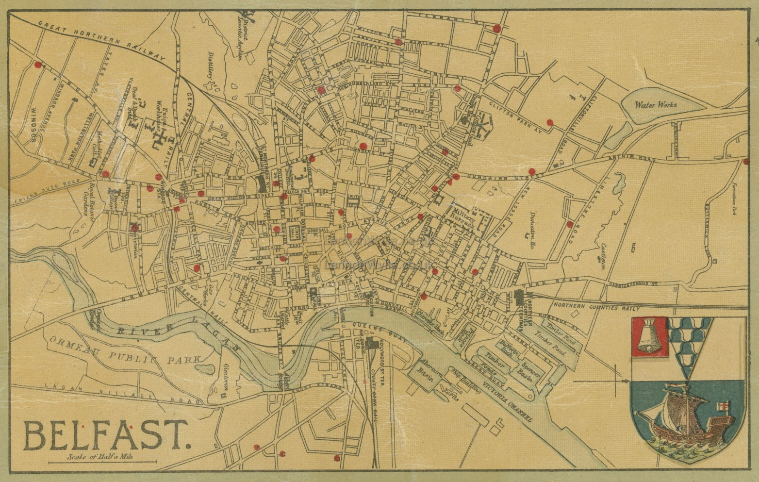
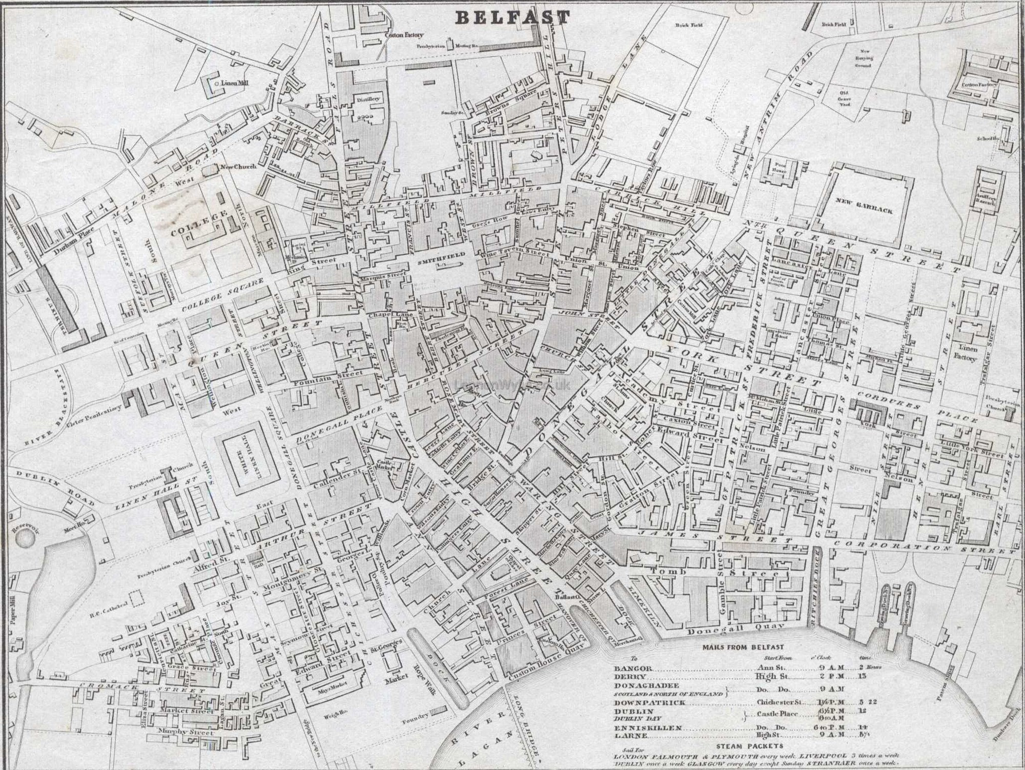
Map of Belfast 1890 click to enlarge |
|
|
|
|
|
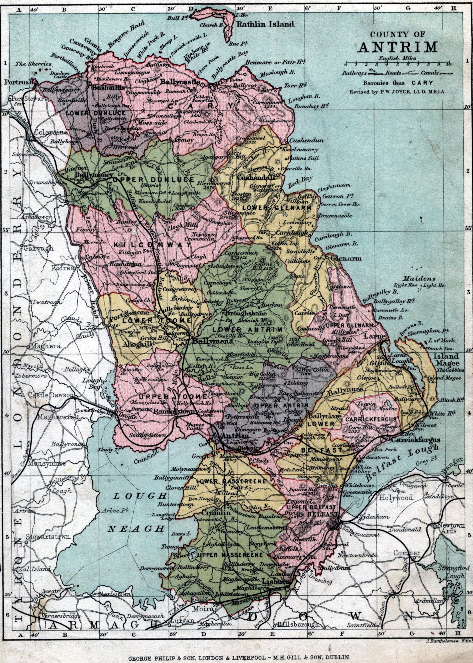
Antrim good detail, 1882
CLICK to enlarge thank you Steve for the year :o) It's taken from Philip's handy atlas of the
counties of Ireland,
please remember to credit Lennonwylie if sharing, |
|
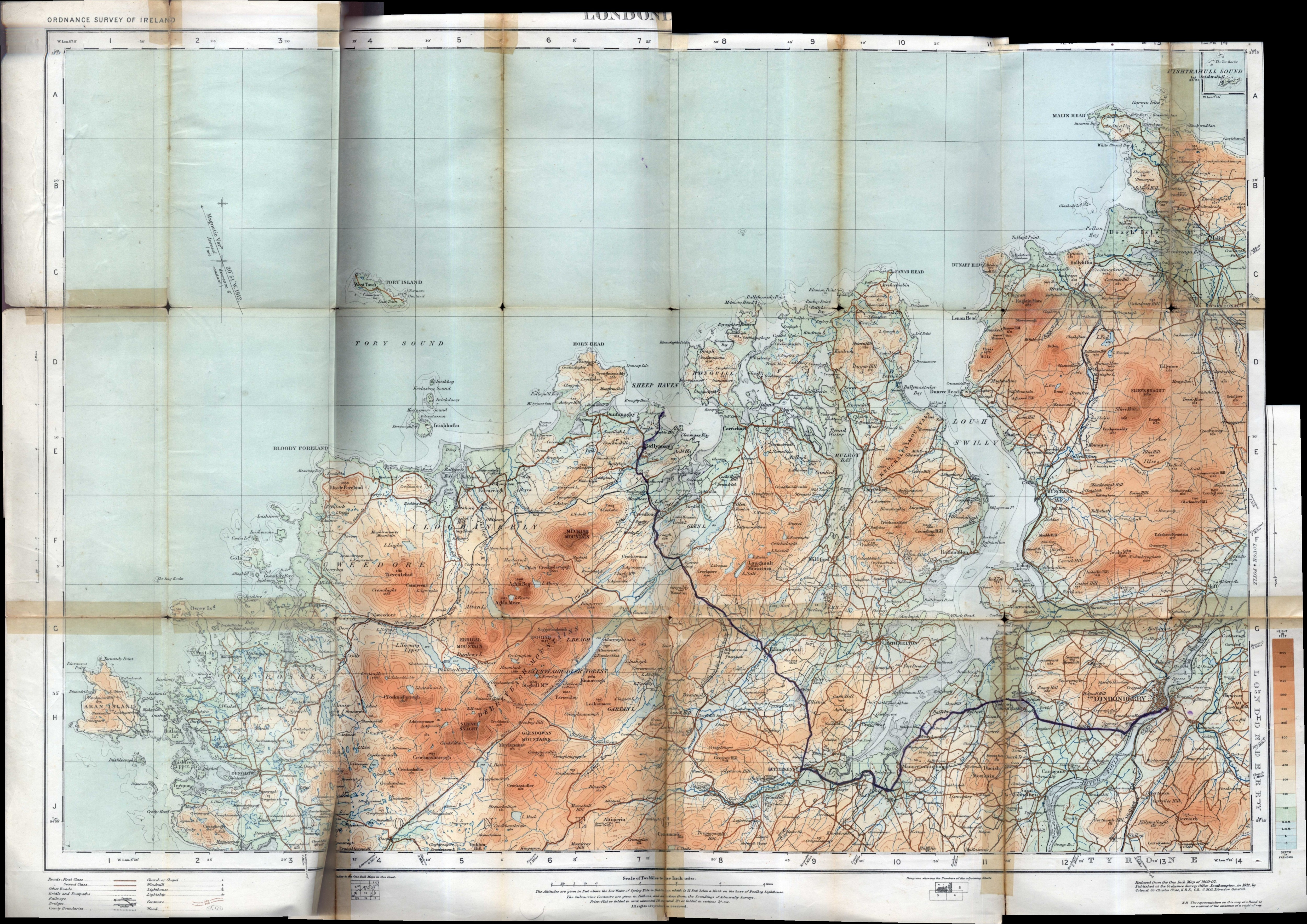
a cracker map of Londonderry and
district, covers a wide |
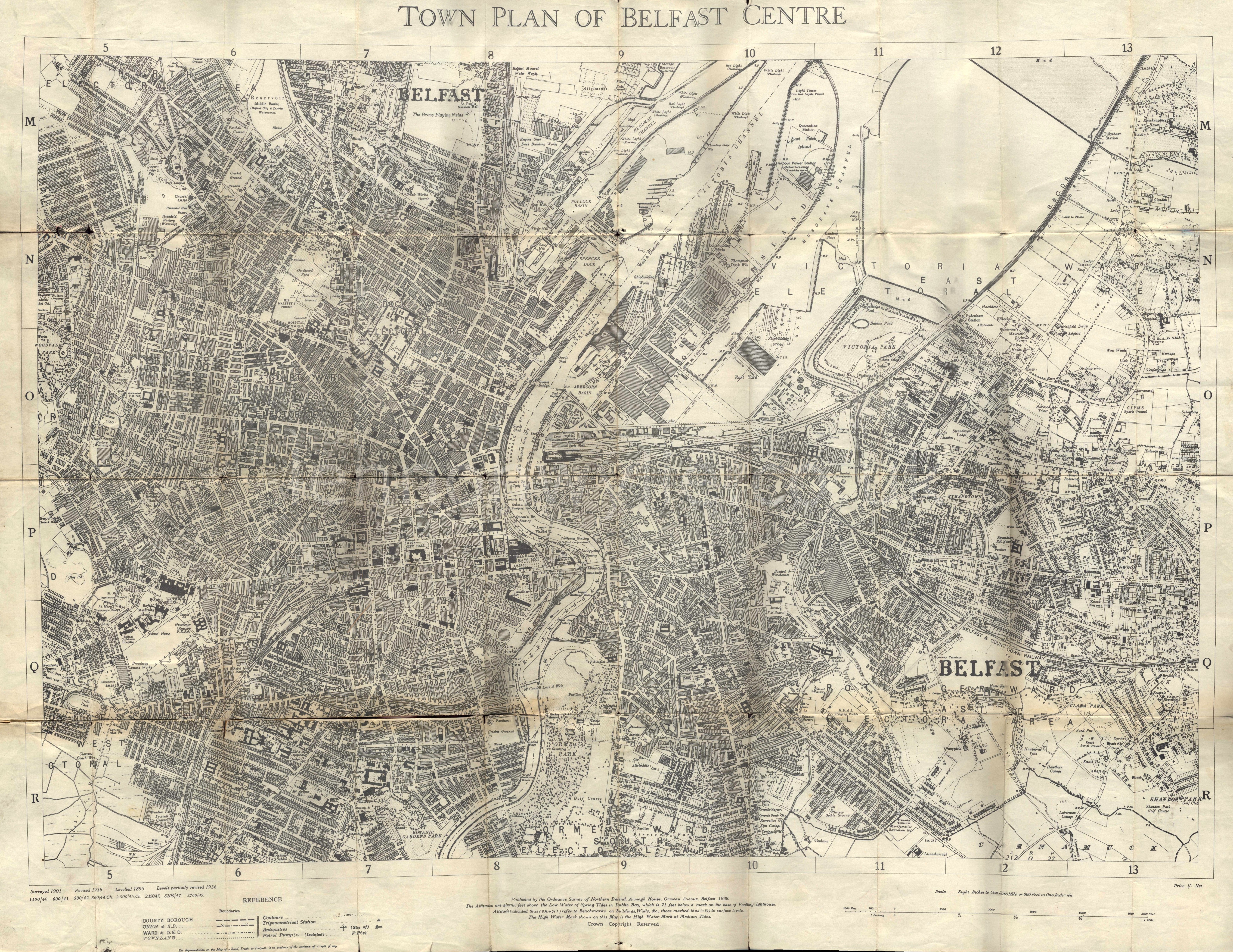
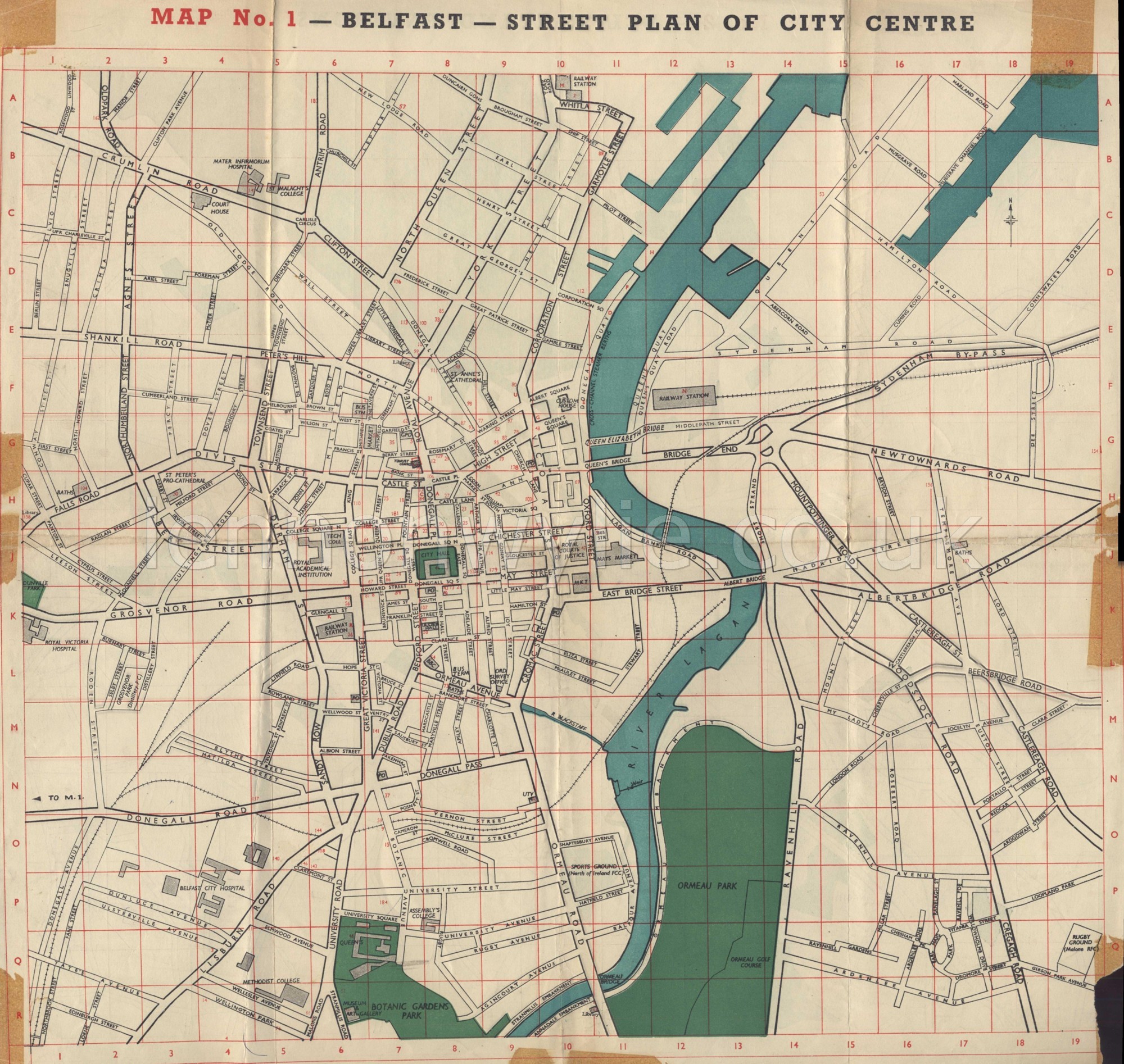
1938 Map of Belfast, great detail |
|
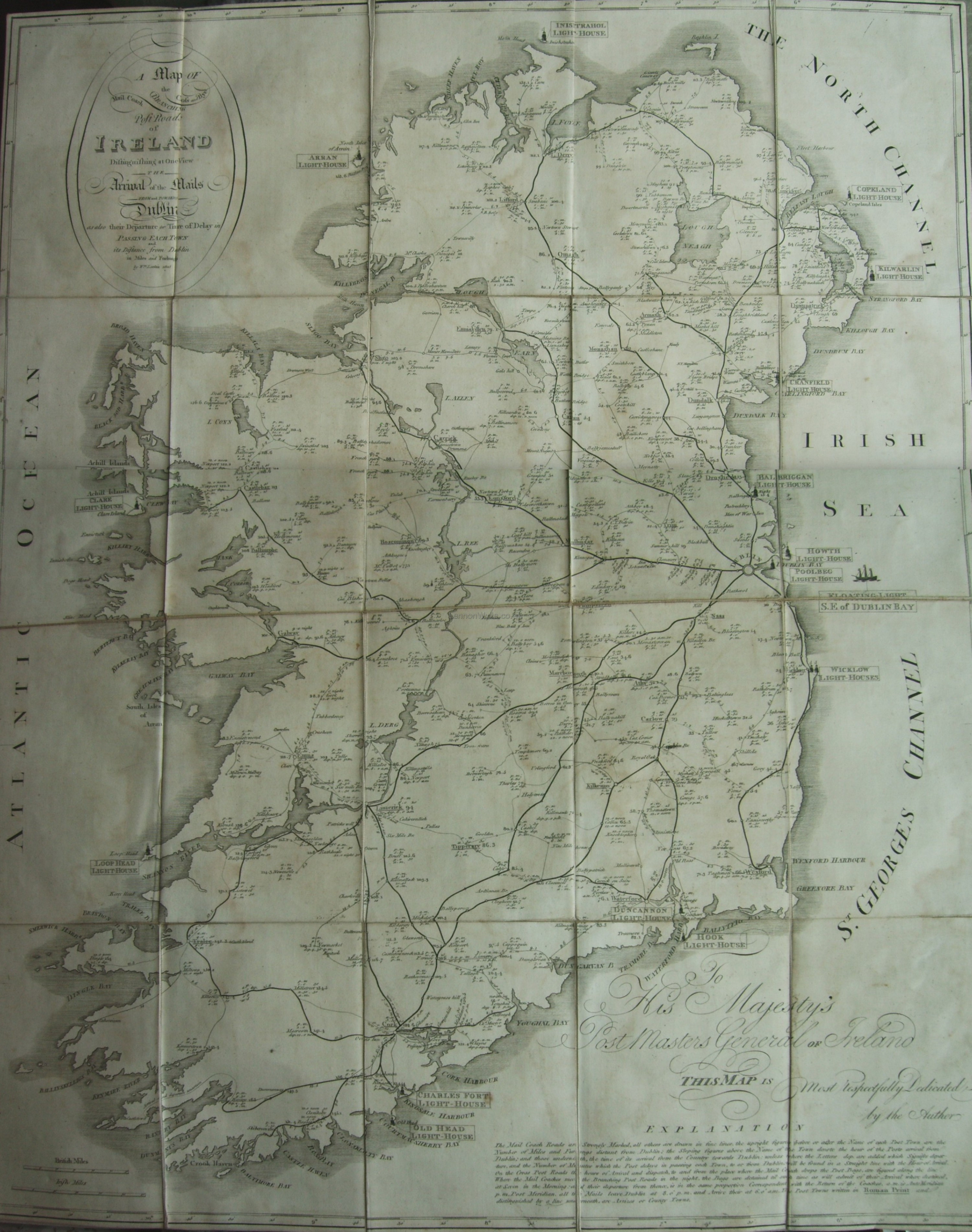
Map of Ireland 1863 |
|
|
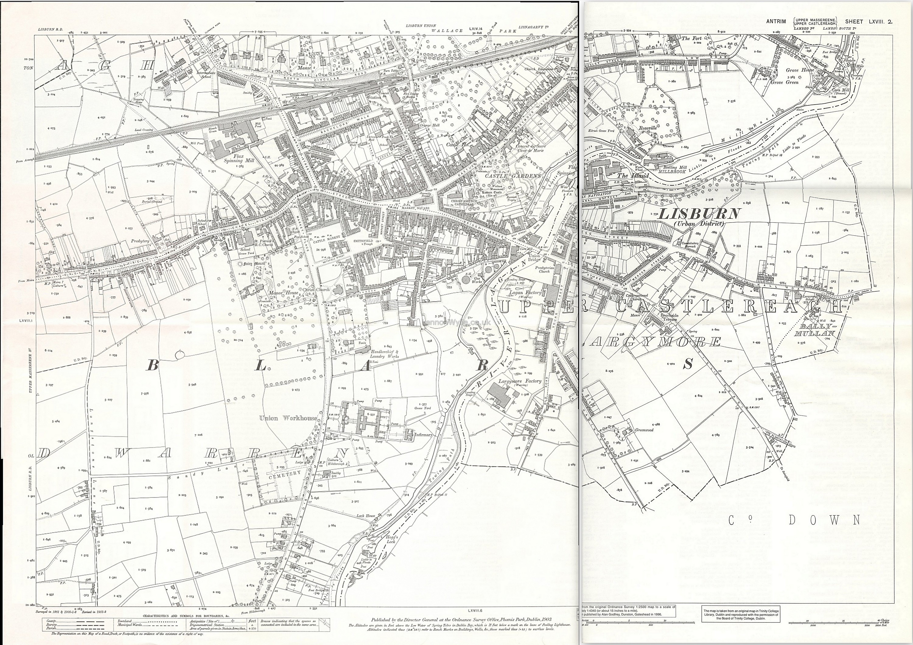
Lisburn District 1903 |
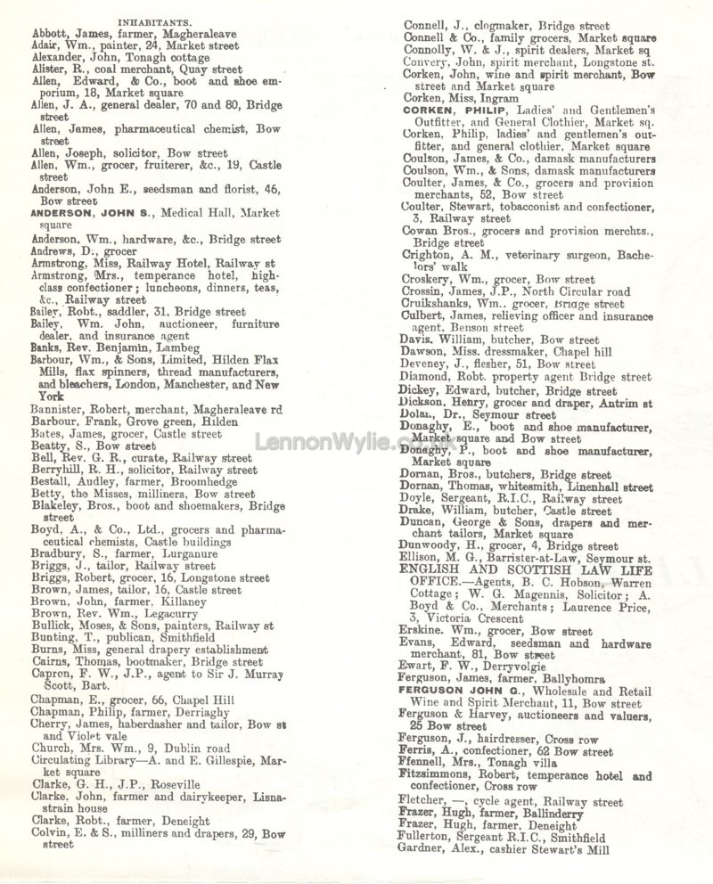
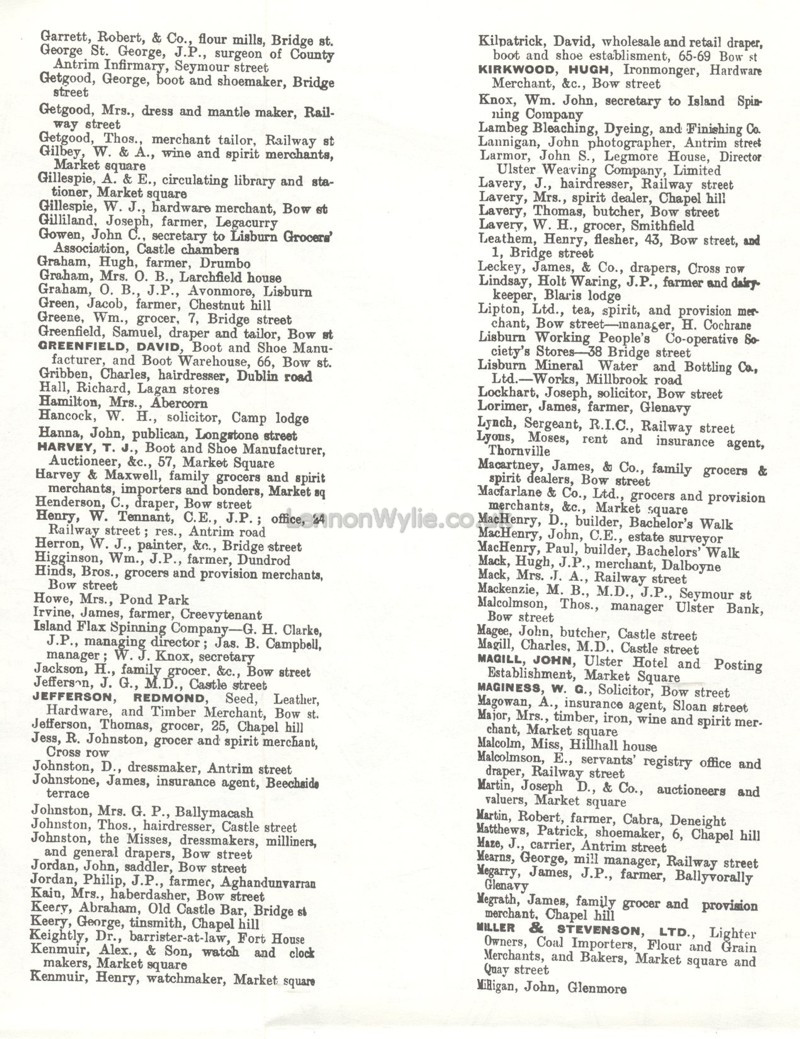
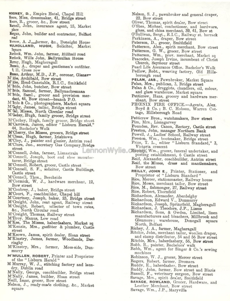
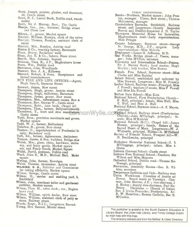
< Lisburn inhabitants to go with 1903 Lisburn Map
|
|
please remember to credit Lennonwylie if sharing a link back to this page or the site would really be appreciated, thank you
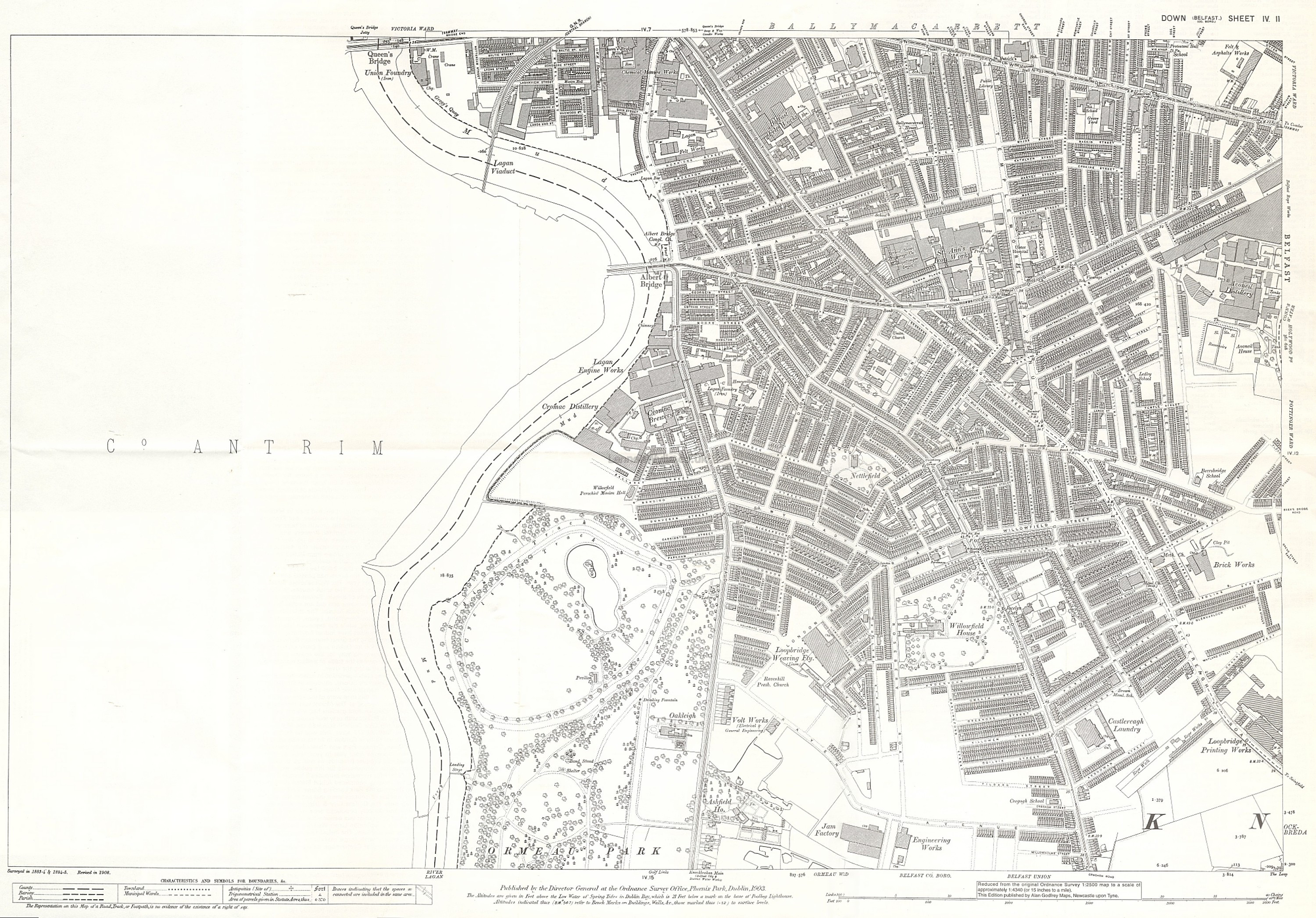
Antrim Ballymacarrett 1902 a little
blurry but streets can be made out |
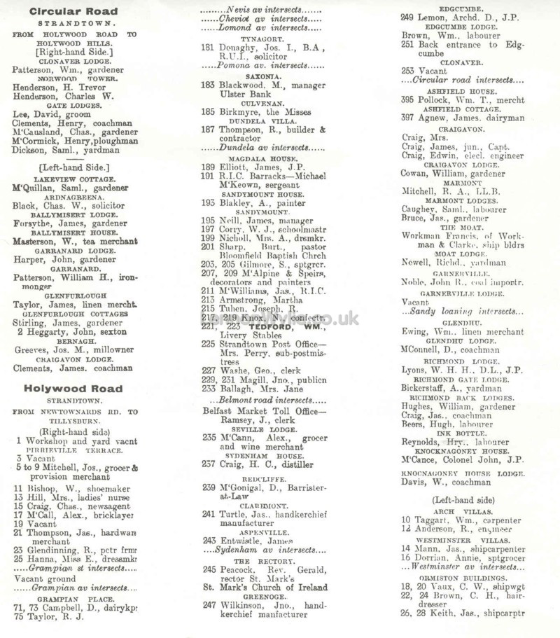
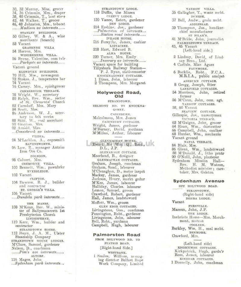
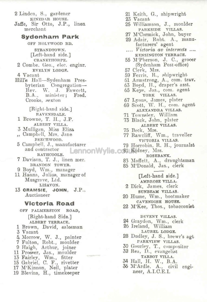 1902 - CLICK to enlarge Circular Road, Holywood Road, Palmerston Road, Sydenham Avenue & Victoria Road |
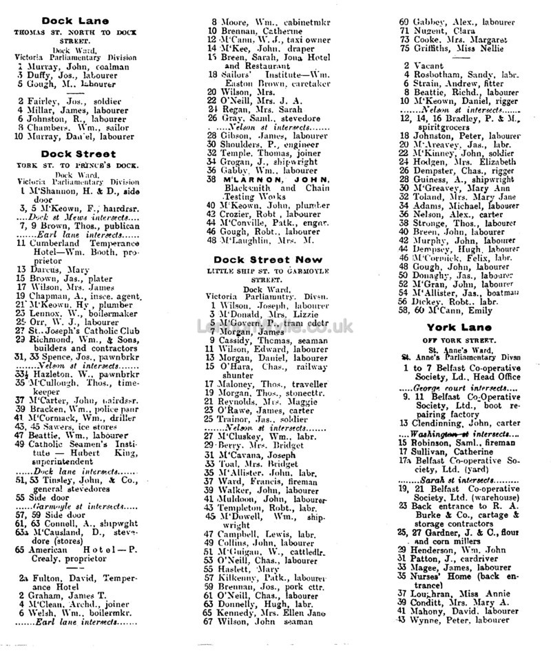

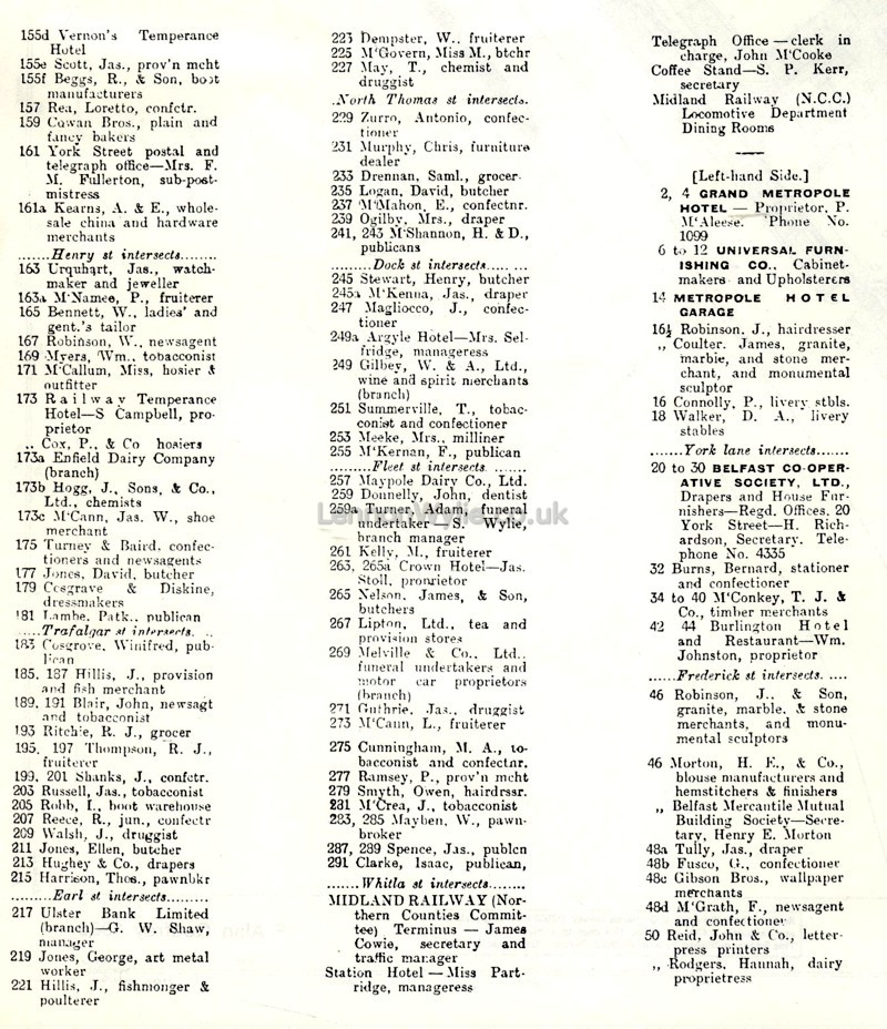
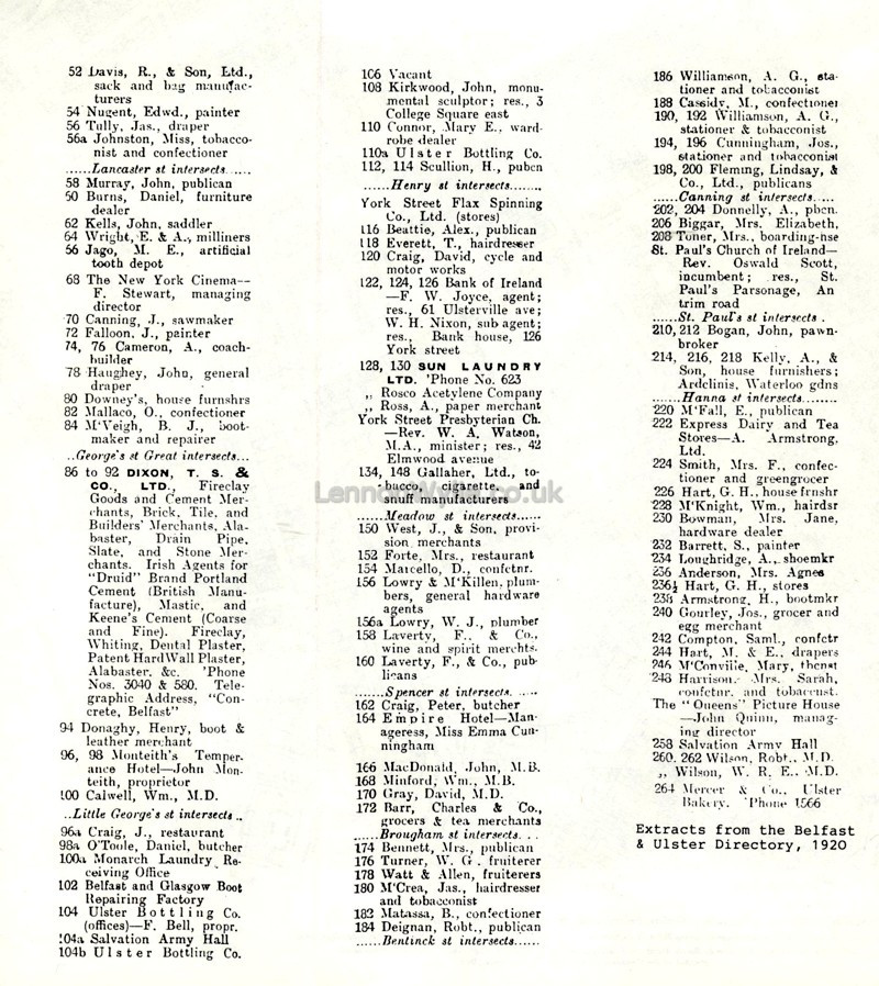 1920 Dock Lane, Dock Street, York Lane, York Street |
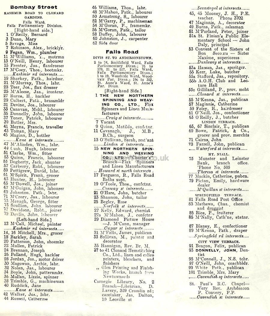
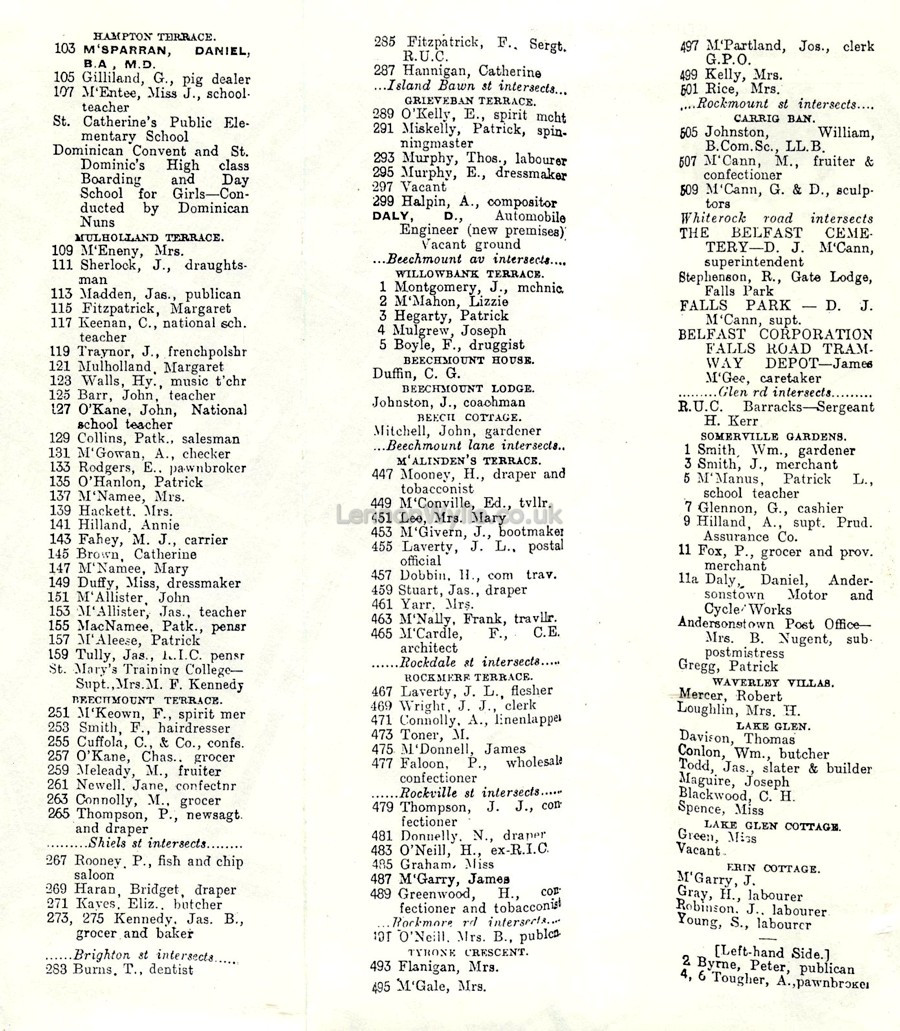
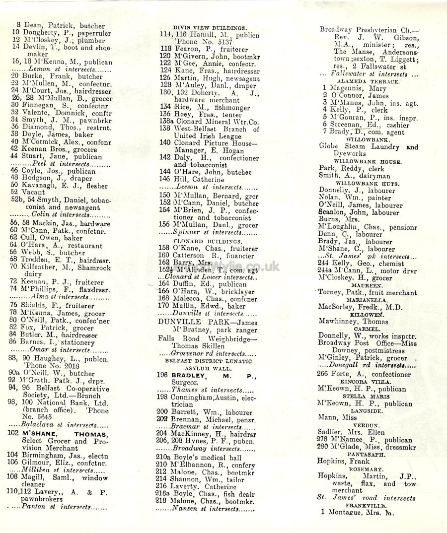
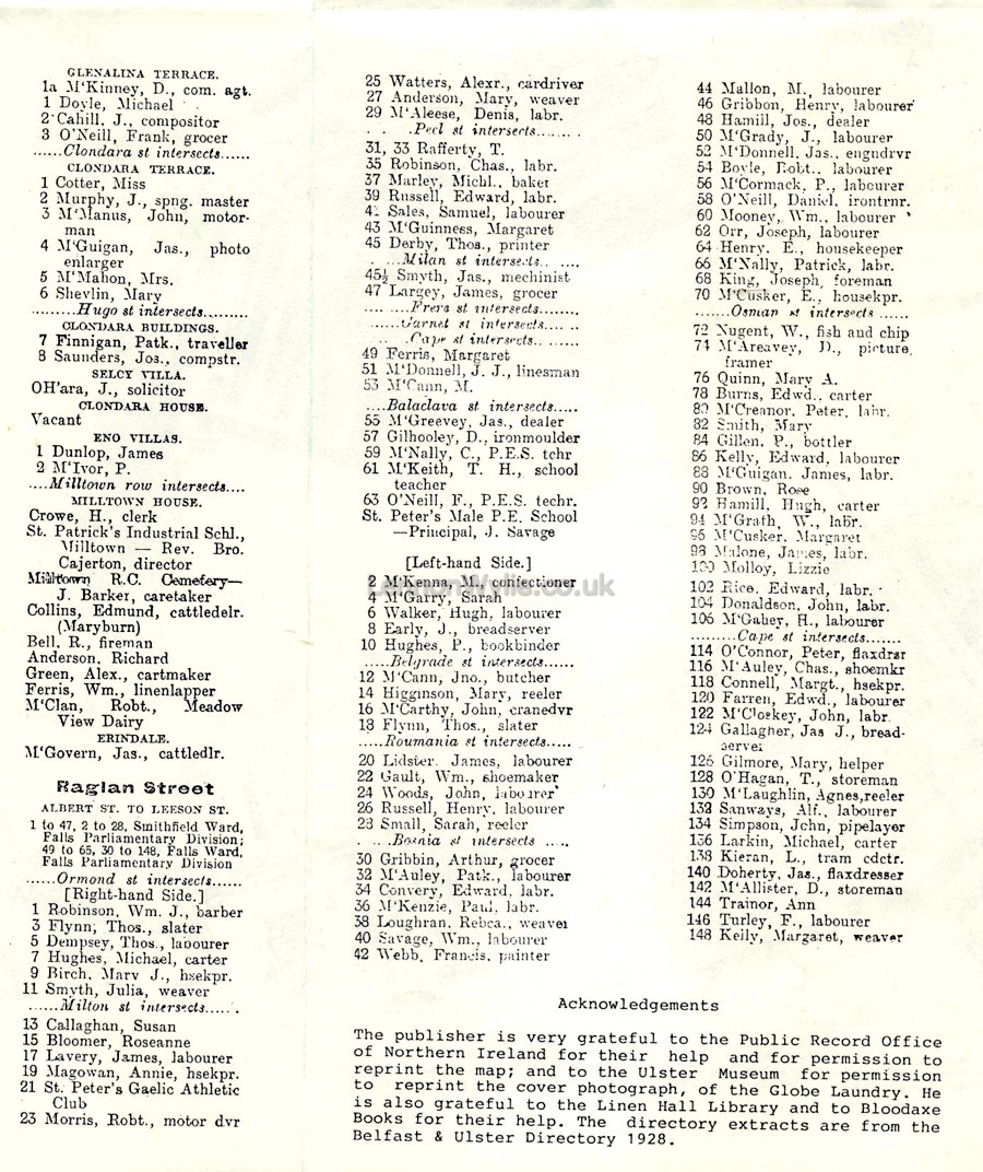 1928 Bombay Street, Falls Road, Raglan Street |
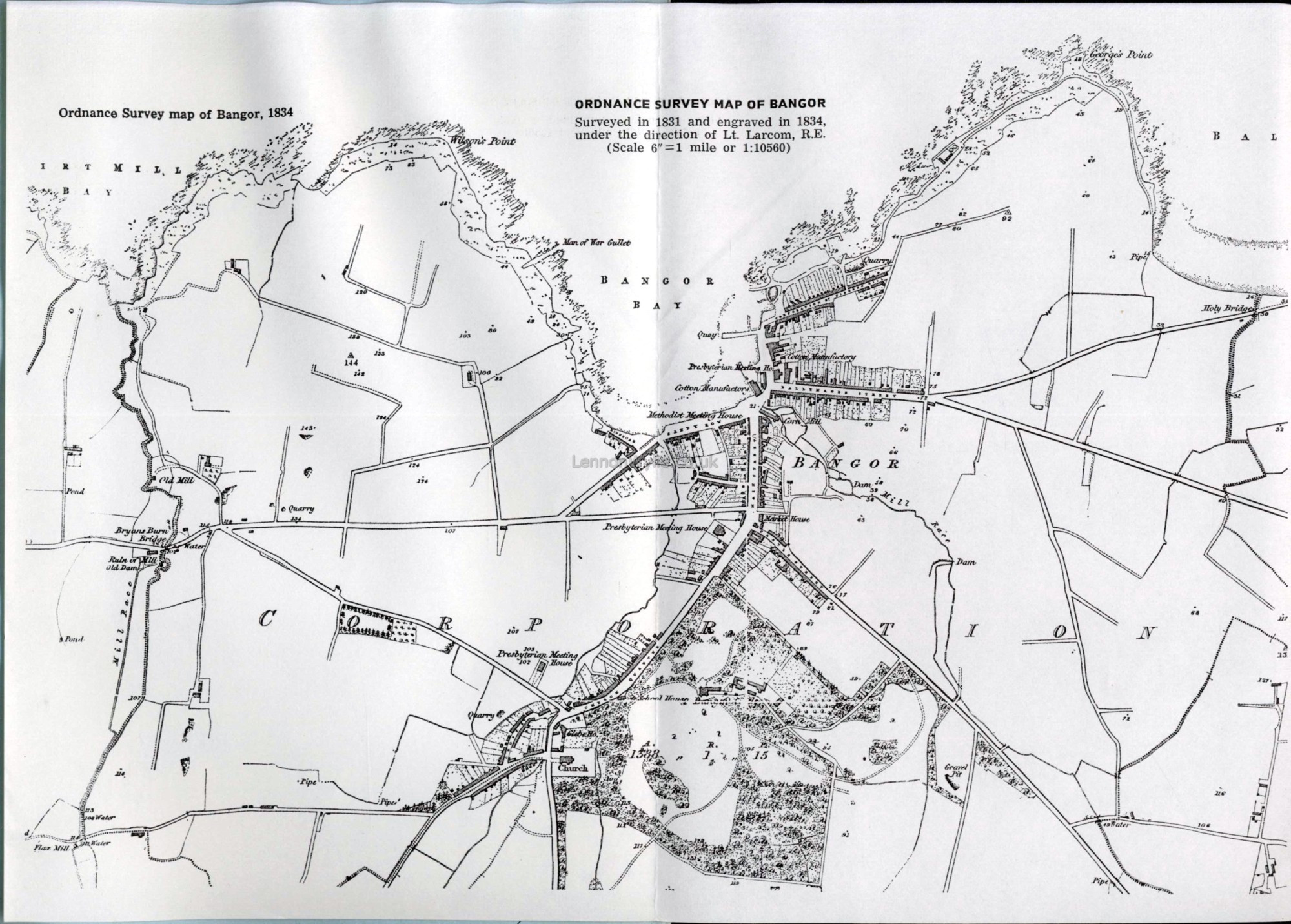
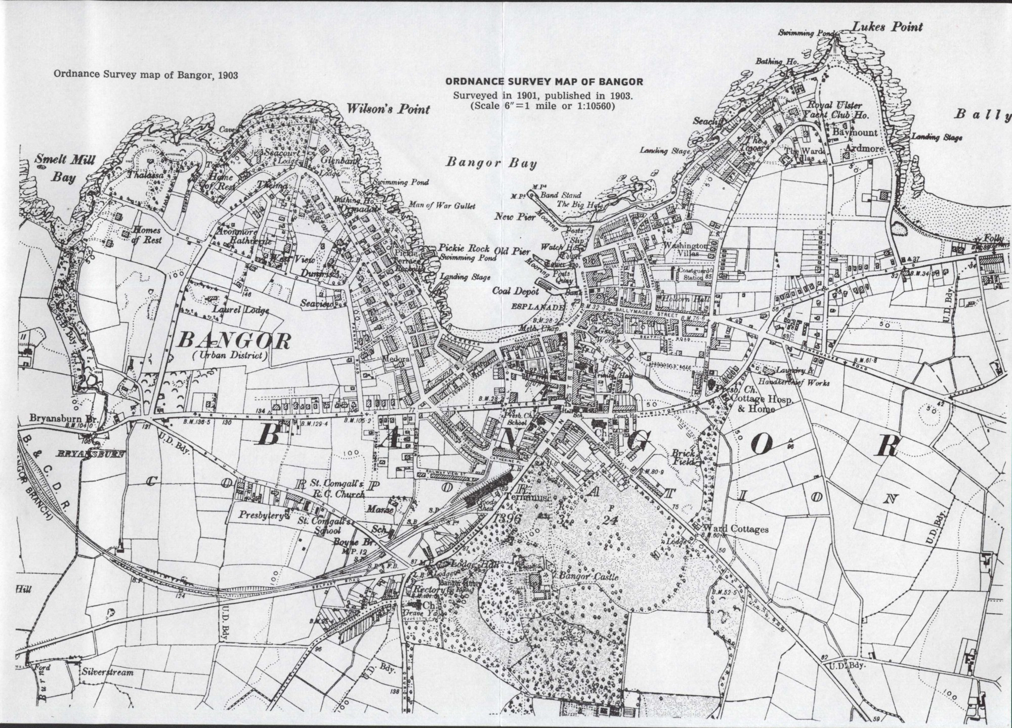
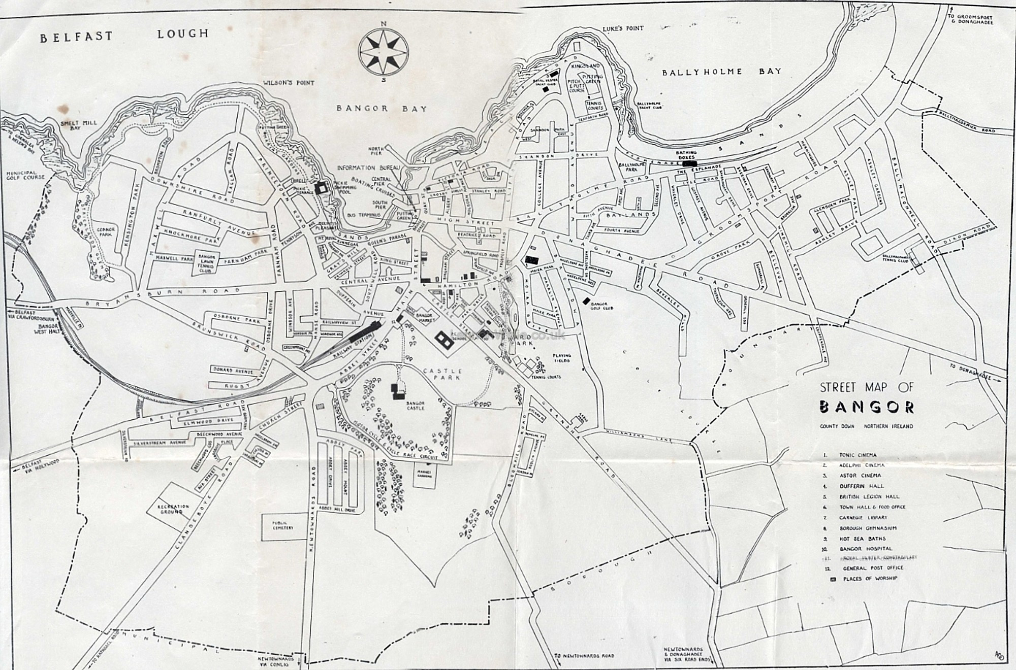
| Maps of Bangor CLICK to
enlarge please remember to credit Lennonwylie if sharing a link back to this page or the site would really be appreciated, thank you
1834 1903 no date on this but its at least 1960 |
|

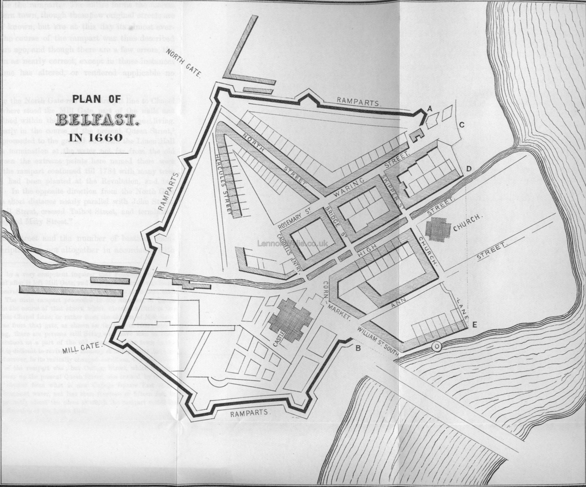
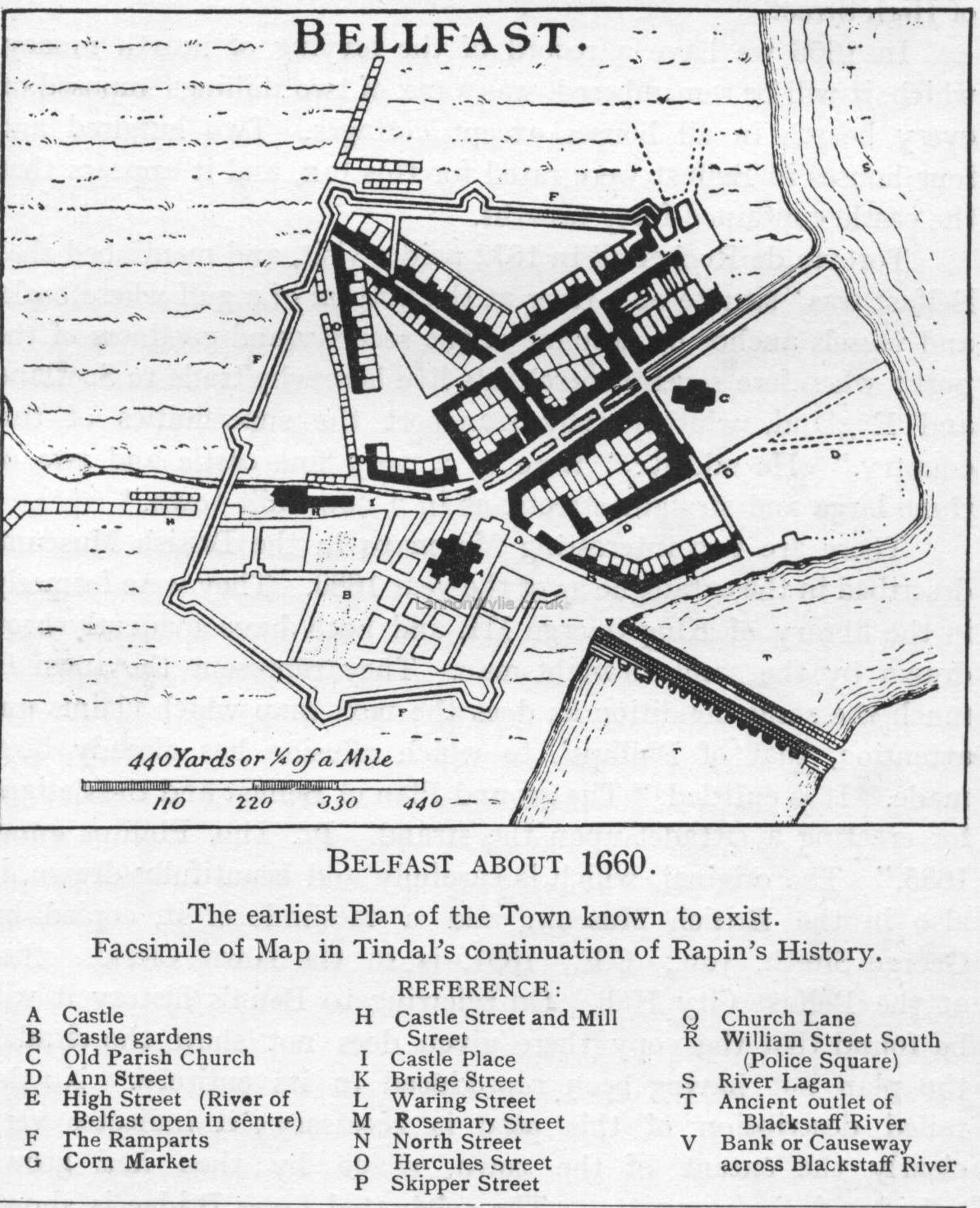
Belfast and Antrim 1657 Belfast 1660
Bellfast 1660
CLICK to enlarge |
 Great Map of Belfast but sadly no date CLICK to enlarge  on the back of it ? |
 Belfast 1960 A Belfast 1960 B |
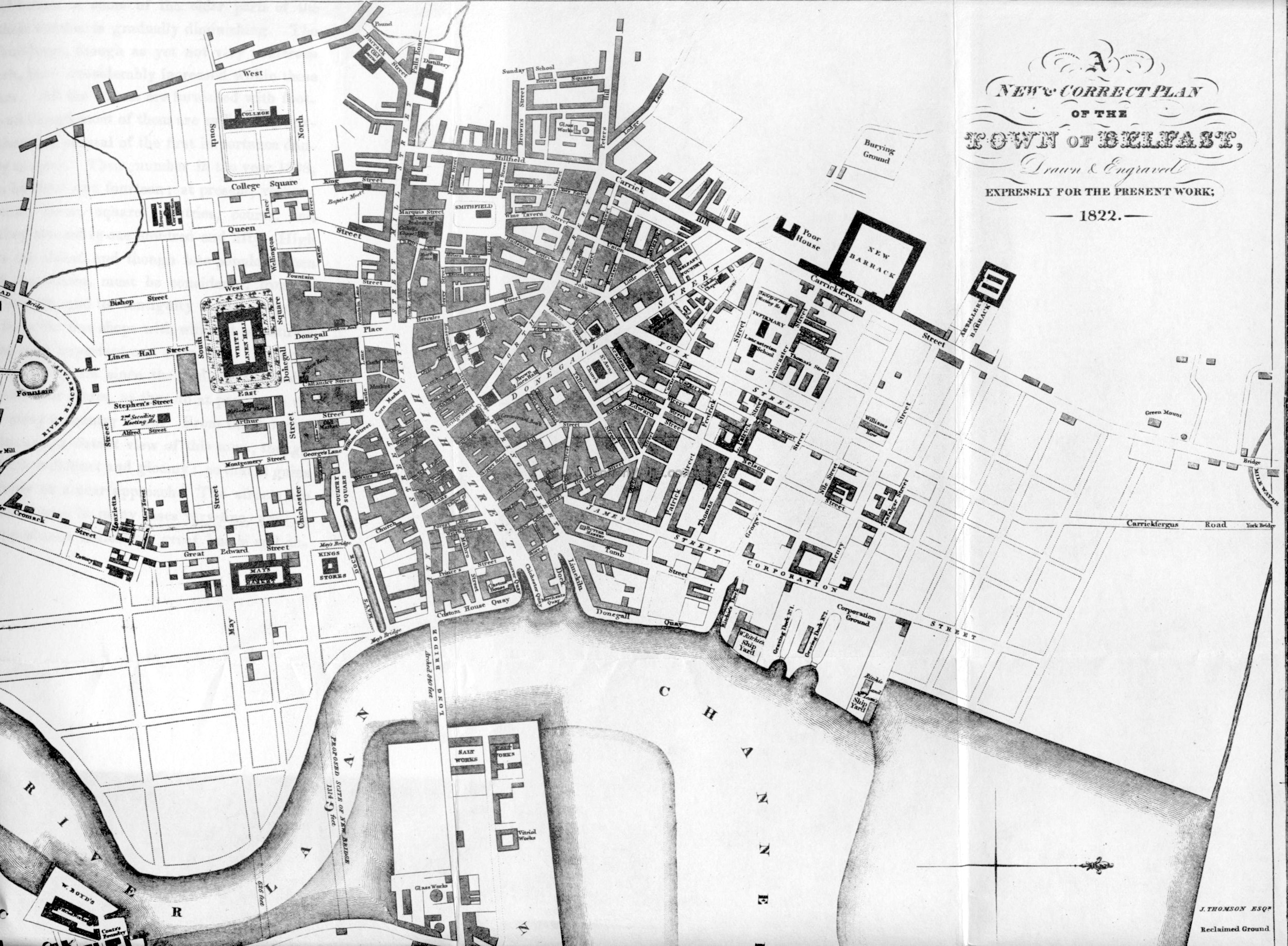 Belfast 1822 from Benns 1823 |
 1675 |
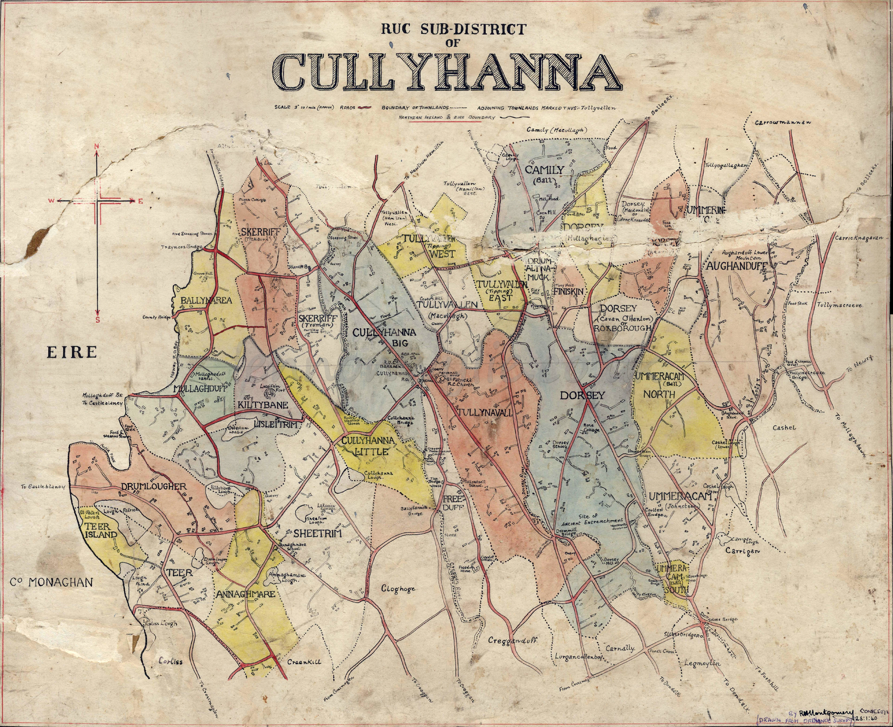 Cullyhanna by R. H. Montgomery Const. 5072 Drawn from Ordnance Survey 28:1:40 more Robert Hanna Montgomery items and information here |
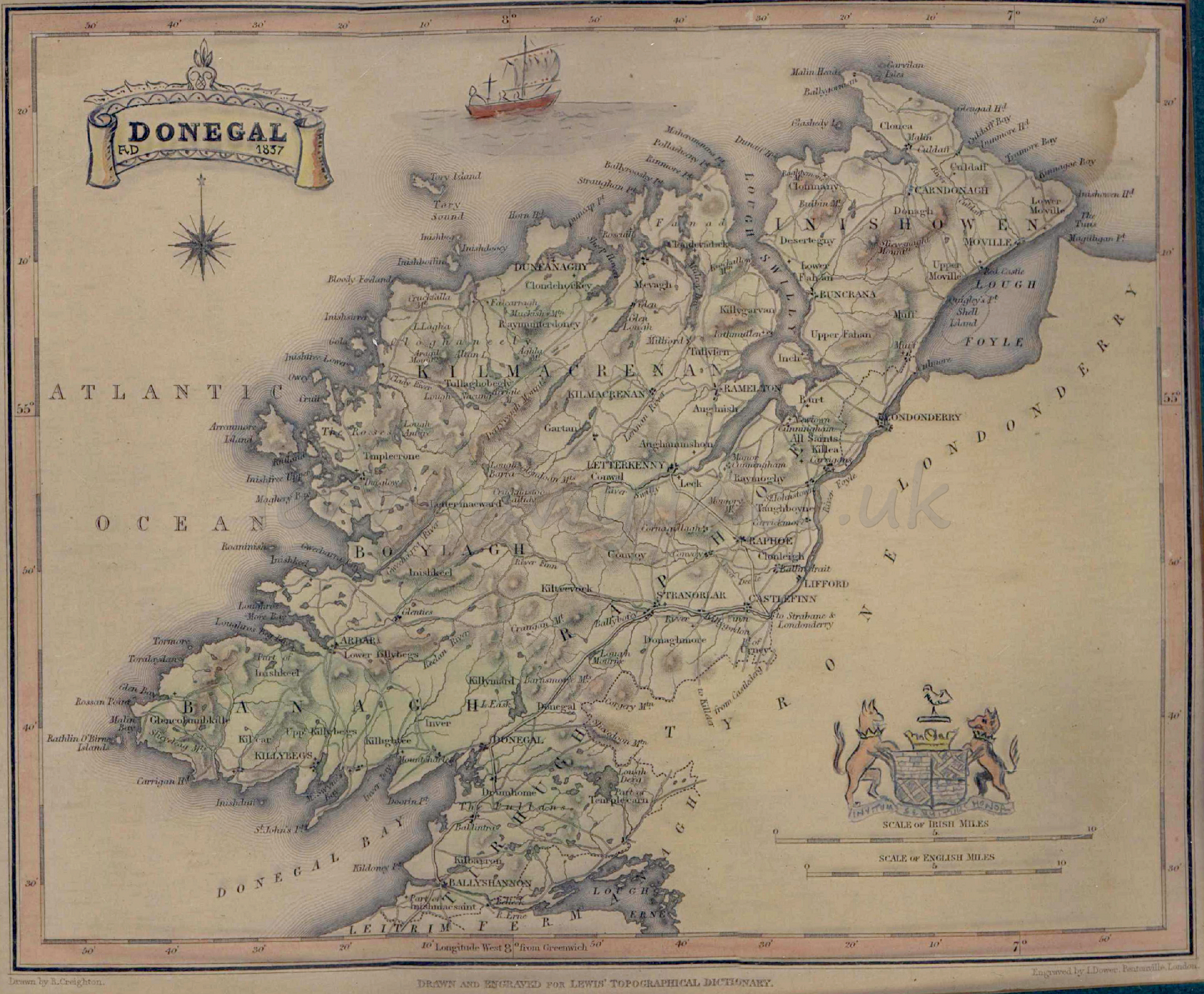 Donegal 1837 |
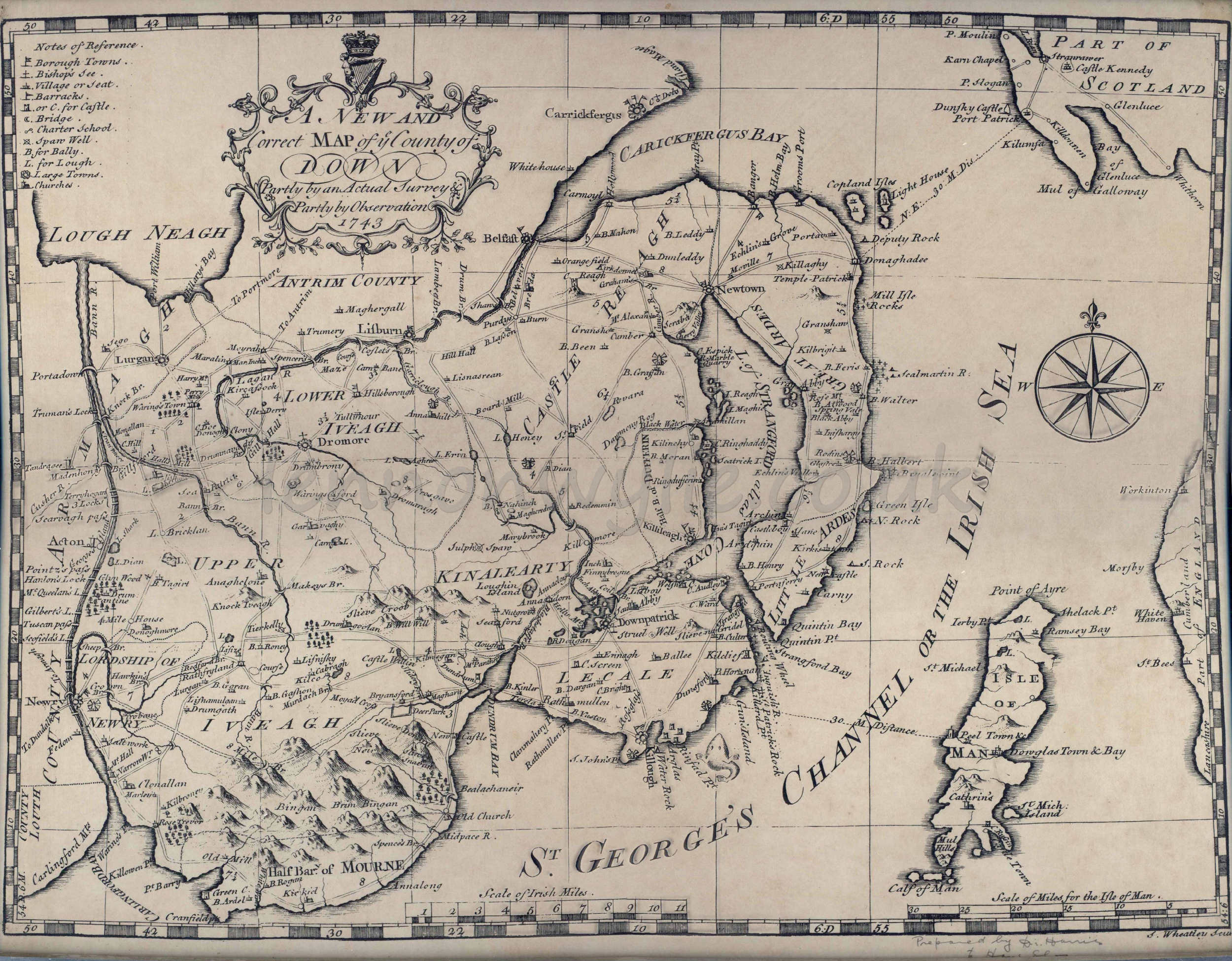 A New and Correct Map of ye County of Down 1743 |
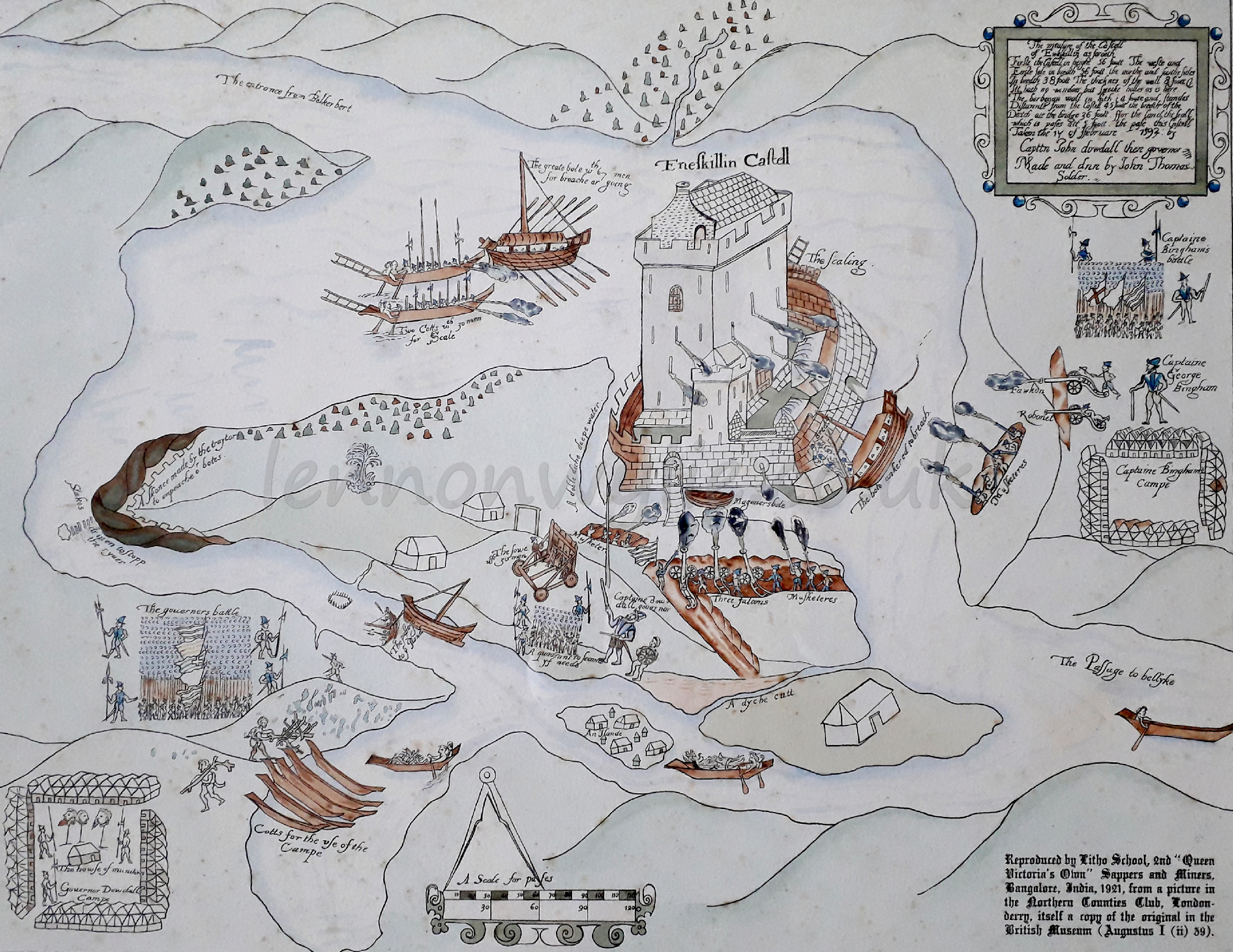 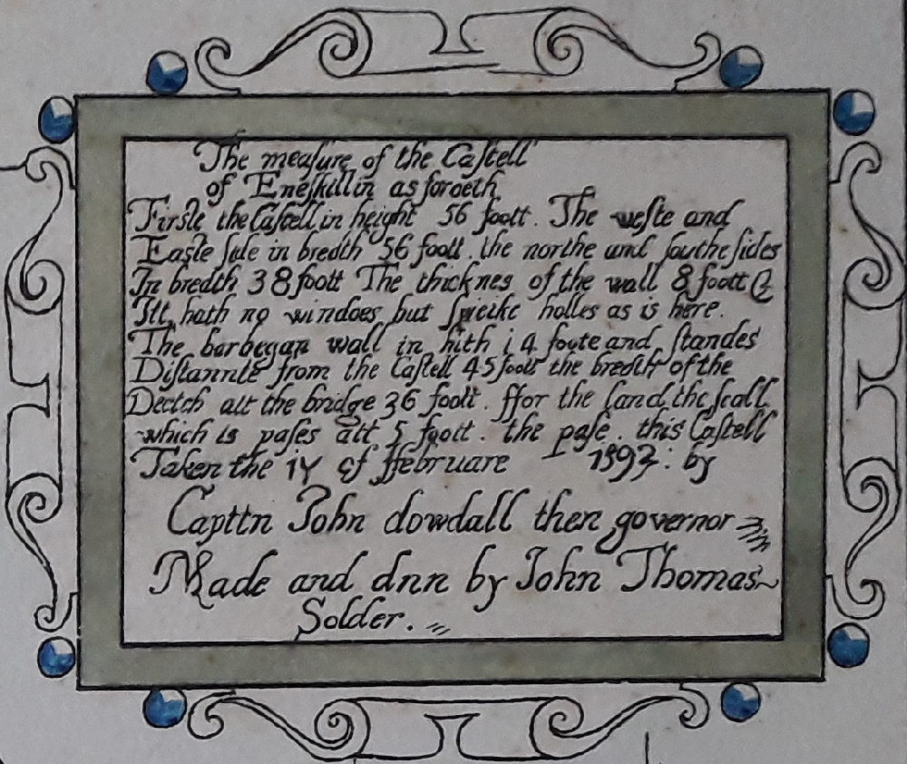 Enniskillen 1594 |
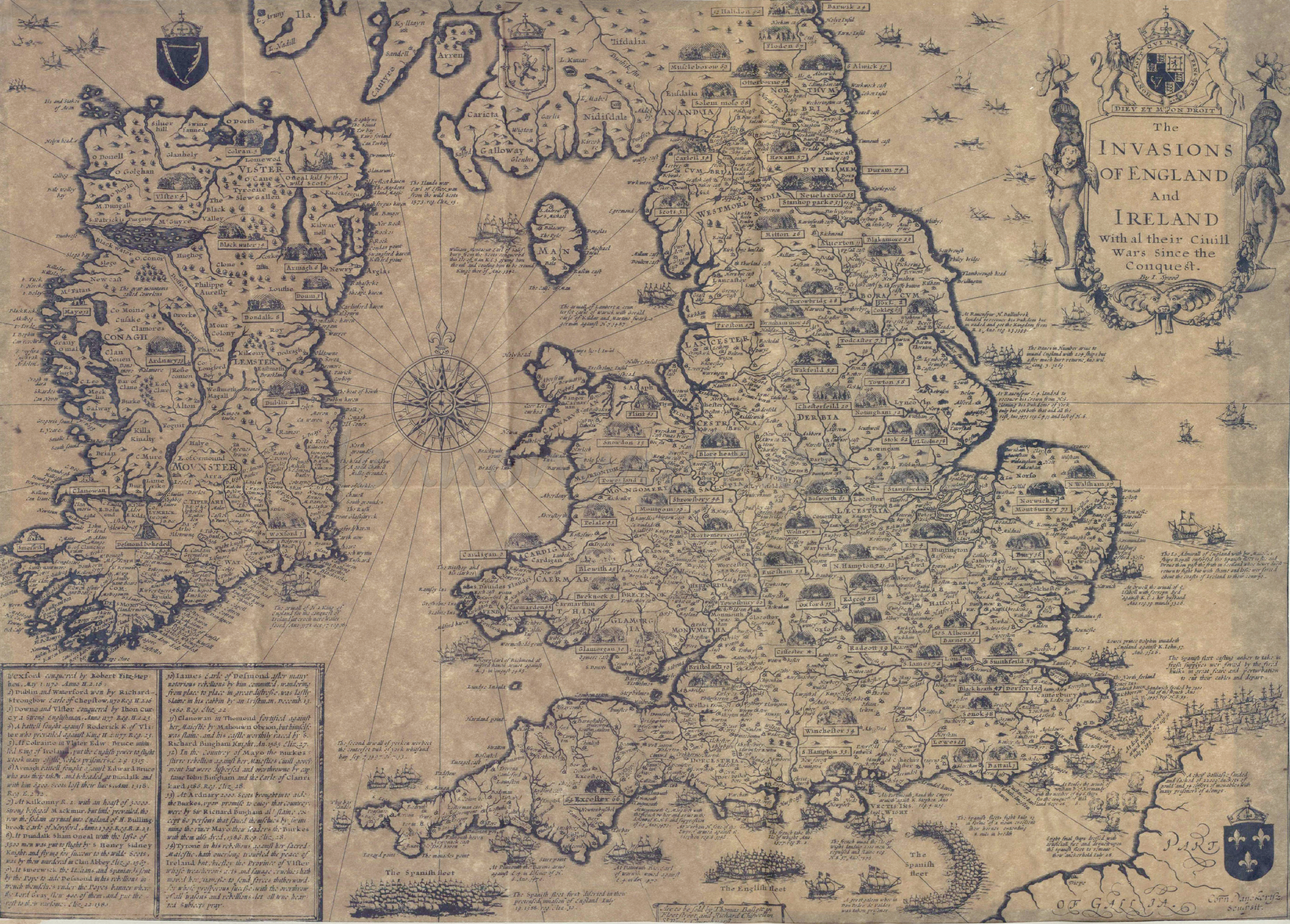 The Invasions of England and Ireland not the clearest map |
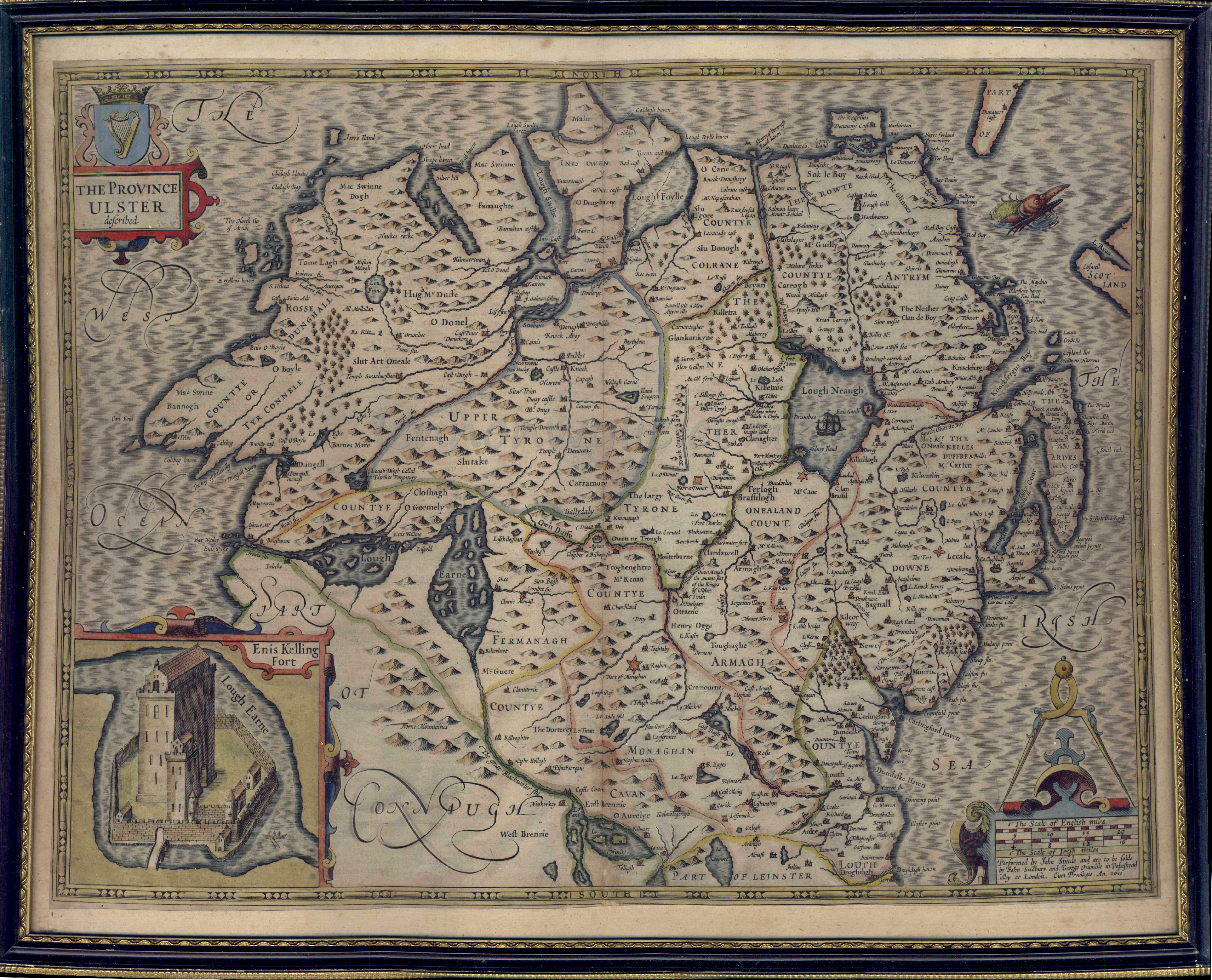
 The Province of Ulster 1610 |
 Towns of Ireland 1744 wee bit blurry in places |
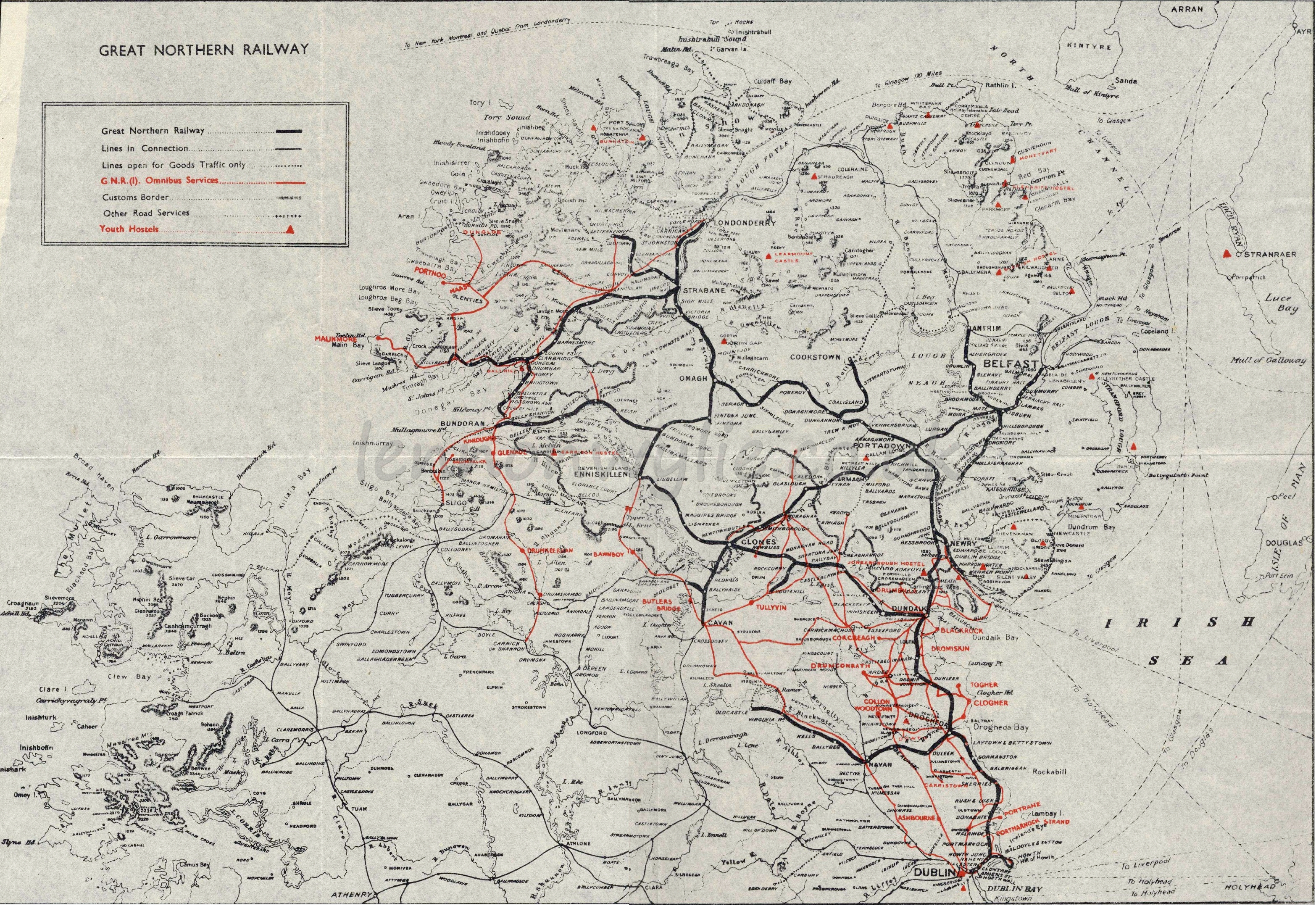 G.N.R. Map no date but probably not that old |
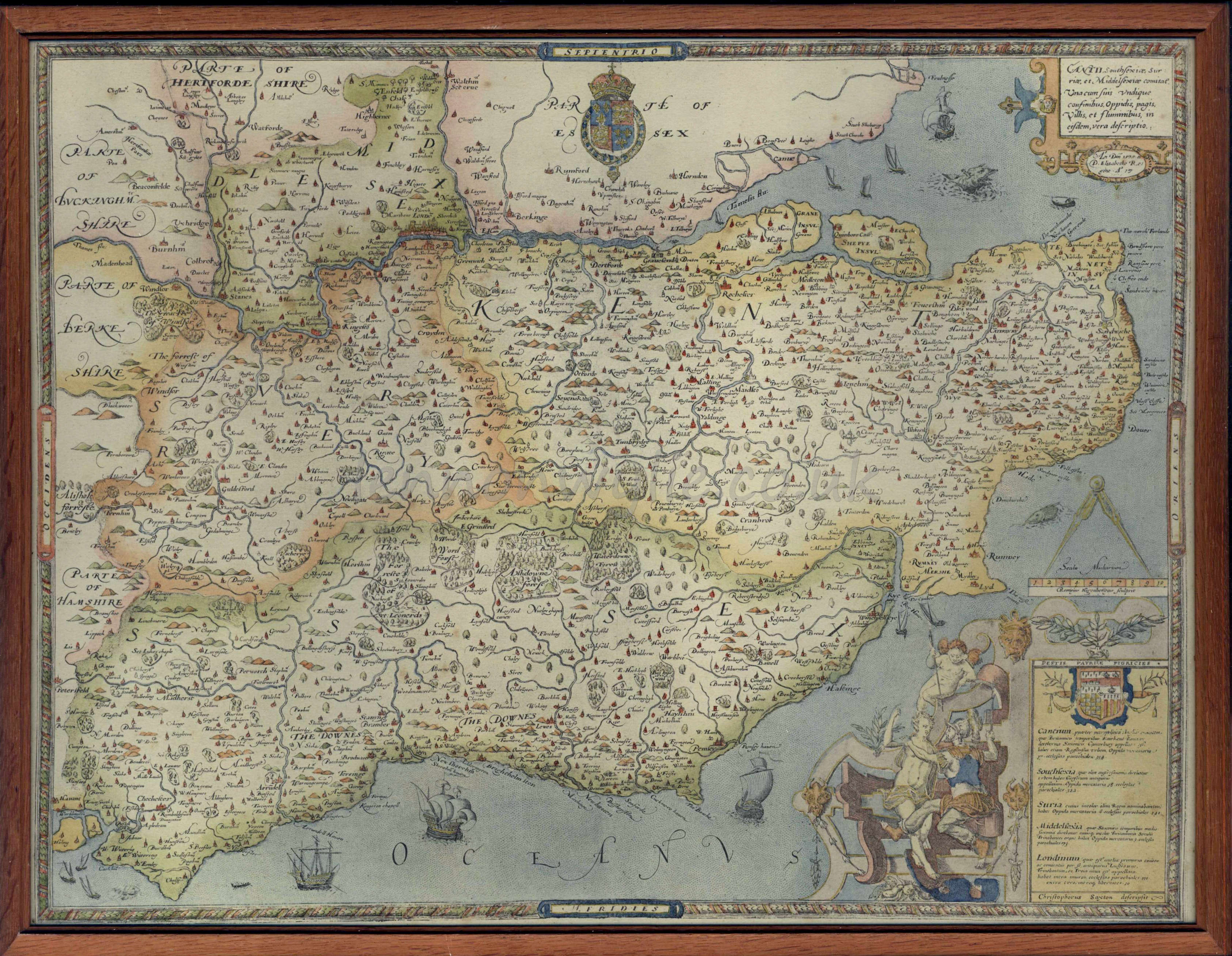 Kent maybe 1575? not Ireland but too pretty not to put up |
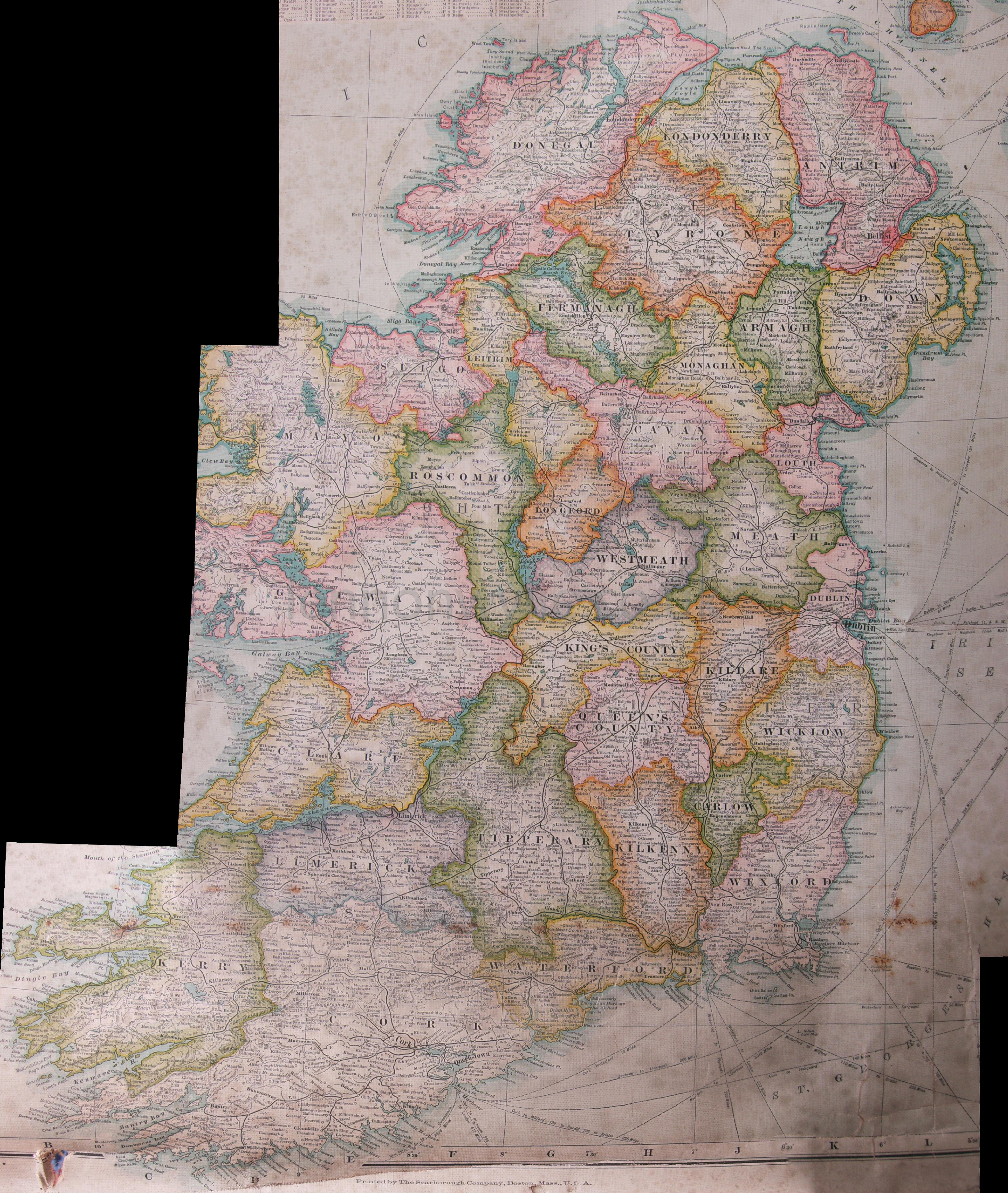 a really messy but very clear map of Ireland year maybe 1911ish? CLICK to enlarge |
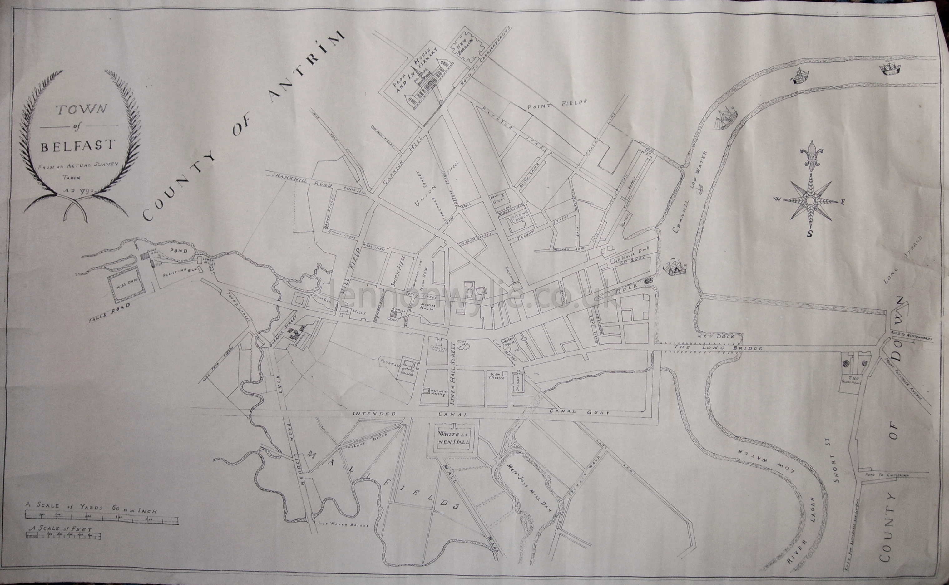 Town of Belfast from an actual survey taken AD 1790 not the clearest map |

 Ordnance Survey of N.I. Mid-Down Revised 1937 |
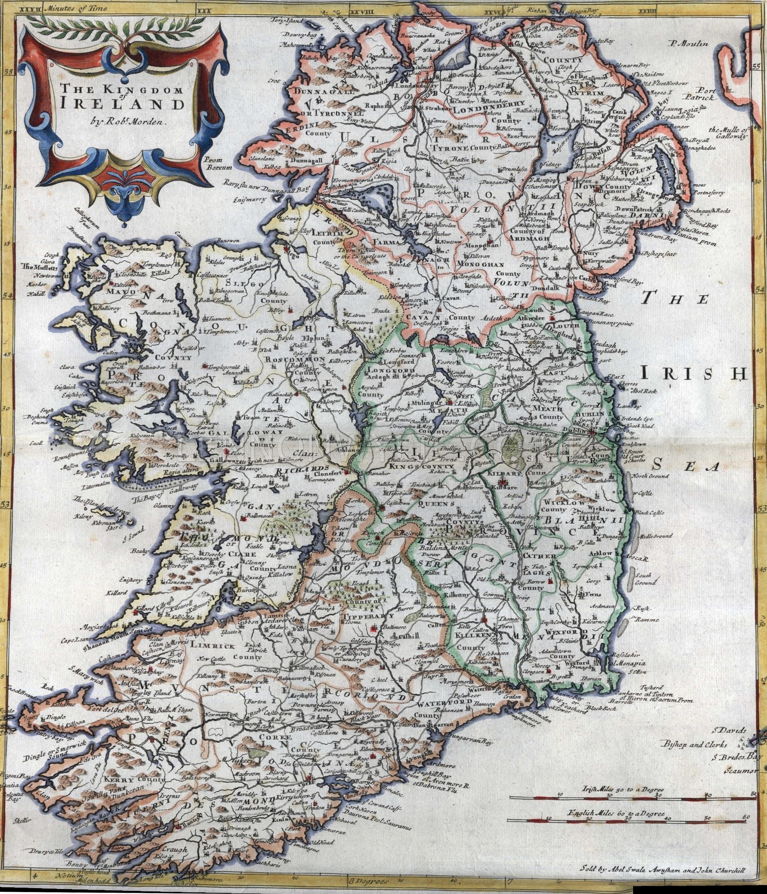
 Map of Ireland - no date |